|
Here are some examples of how GPS Technologies might be used in the classroom:
Lesson Plan Example 1: Earth’s Circumference Students use a line of longitude to walk over 100 meters. Then, use a similar proportion as Eratosthenes to determine the circumference of the Earth. Some additional data analysis work can be completed to extend the lesson. Lesson Plan Example 2: Civil War Interactive Maps Much like Lesson Plan Example 1, students share a map. In this lesson, students choose a battle and add information regarding the location, battles, and important historical figures. When completed, students have an interactive map which displays a great deal of information regarding the Civil War. Consider how students might map an historical event that occurred in your community. Lesson Plan Example 3: Mapping The Refuge The lesson has students inventory an area of a wildlife refuge at different times during a school year. Students use a GPS to mark their location, then add the data to a pin on a map. All students share one map. |
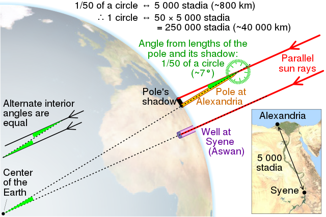
Image: Creative Commons from: https://www.wikiwand.com/simple/Eratosthenes
|